‘Can You Describe What You See Ahead?’ Google Maps, Waze Integrate Gemini AI
 Peter Holmes
01 Nov 2024
Peter Holmes
01 Nov 2024
The data is mind-boggling.
Every month, around two billion people on the planet use Google Maps – for work, play, research, navigation. They measure distances, check the view from the street, have a nosey about people’s backyards on satellite view.
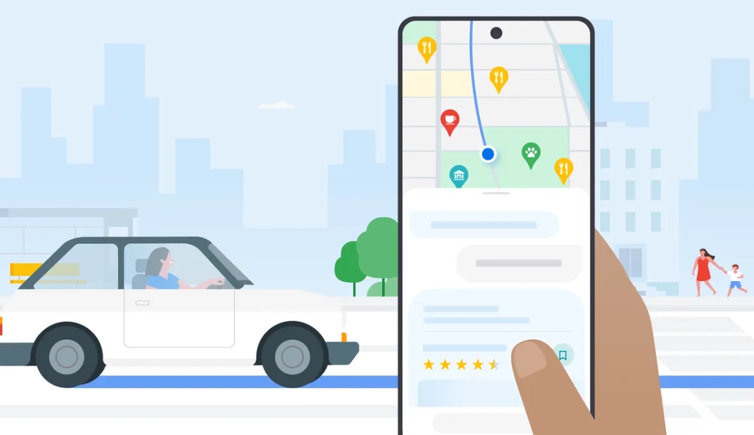
On Friday, Google Maps – which says it makes up to 100 million updates to maps every day – announced the integration of Gemini artificial intelligence.
Although Google Maps already has the capacity to offer suggestions about where to go and what to do, it says Gemini will make it easier.
“Say a friend is visiting and you need to plan an activity,” the company said. “Just ask Maps for ‘things to do with friends at night’ to get ideas curated with Gemini — like checking out a speakeasy or live music. Find out what people like about a place by reading [reviews] summarised with Gemini … If a place catches your eye and you want to learn more about it, like whether it has outdoor seating or a quiet atmosphere, just ask Maps questions to get relevant answers.”
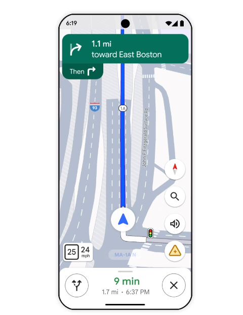
Google Maps lane selection.
Google Maps puts the improvements down to Gemini’s “creation, reasoning and summarisation capabilities — grounded in our trusted data about 250 million places around the world and insights from the Maps community”.
The new features will start rolling out this week in the US on Android and iOS.
“Similar experiences” – including AI-powered review summaries and the option to ask detailed questions about places – will come to Google Search in coming months, the company said.
Google Maps says part of the new “major update” will make it easier to explore along your route before you get on the road by getting directions and tapping “add stops”. Google says in response you’ll “see top landmarks, attractions, scenic spots and dining options …”
It says enhanced navigation will be able to help in unfamiliar areas “with multiple lanes, forks and exits” by showing lanes, crossings and road signs on the map.
“And because no one likes finding out they need to merge at the last minute, we’ll show you exactly which lane you should be in: Just follow the blue line in the lane markers while navigating.”

Google Maps’ Immersive View.
People will be able to report weather disruptions including flooded or and low-visibility roads, and view other postings by other drivers or passengers.
At the end of a journey Google Maps will light up the destination building and show nearby parking options.
Immersive View, launched for driving routes a little over a year ago, allows users to “experience what stadiums, parks and routes look like using AI, imagery, and computer vision — and even see what the weather and traffic conditions will be like on the day and time you’re planning to visit”.
Immersive View for routes was originally rolled out in Amsterdam, Barcelona, Dublin, Florence, Las Vegas, London, Los Angeles, Miami, New York, Paris, San Francisco, San Jose, Seattle, Tokyo and Venice on Android and iOS.
This week Google Maps says it will expand to 150 cities globally, adding the likes of Brussels, Kyoto and Frankfurt.

Waze.
Meanwhile, Waze maps – which are popular for their ability to point our hazards such as accidents, vehicles parked on embankments and, as drivers beyond the city limits soon learn, roadkill – has announced changes. Waze also points out police speed traps and roadside testing operations.
Waze previously had voice activation via Google Assistant (check your app settings) but is introducing a new “conversational reporting” feature to simplify making a report about traffic conditions. Waze says if you spot a situation, you can tap the reporting button and talk to the map via Gemini.
“With the help of Gemini capabilities, Waze will understand what you’re saying and quickly add a real-time report to the map for you — no need to use a specific voice command or tap extra buttons.”
Waze may ask follow up questions such as “Can you describe what you see ahead?”